Payment for this pre-order will be taken when the item becomes available
- Delivery and returns info
-
Free CA delivery on orders $40 or over
Description
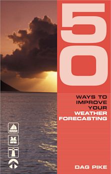
An essential pocket-sized primer that equips sailors and outdoors enthusiasts with the knowledge to read and predict the weather.
Weather determines when we sail, where we sail to – and whether we arrive safely. This essential pocket-sized guide explains how the weather works and how to understand and use all forms of marine weather information, whether for day sailing or long coastal and offshore passages.
This new edition updates availability and usage of computer-generated forecasts with a glimpse into the AI future. Climate change impacts on sailors are described and there is a scientifically correct description of the Coriolis effect.
With practical explanations, helpful diagrams and photographs, this is the ideal aide-memoire for skippers and crew, especially those studying for their Day Skipper and Yachtmaster exams.
Table of Contents
Air masses
-Understanding air masses
-Air directly from polar regions
-Air indirectly from polar regions
-Air from the subtropics
-Tropical air
-Air mass with a land track
-Fog
-Sea fog areas
-Other causes of sea fog
-Showers and thunderstorms
-Lightning
-Lightning protection
-Avoiding the risk
-Other dangers of thunderstorms
Fronts and depressions
-Frontal lows and their formation
-What you may see at sea level
-Occluded fronts
-Non-frontal lows
-Relationship of wind to isobars
-Use of synoptic charts
-Forecasting winds
Sea and land effects
-How breezes are formed
-The sea breeze front
-What affects the sea breeze?
-Land breezes
-Sea/land breeze cycles
-How strong? How far out to sea? How far inland?
-Cliffs, straits and headlands
-Summary
Waves and swell
-Understanding sea state
-Wind waves
-Swell
-Water depth and tidal stream
-Reflection and refraction
-Sea state – general advice
-Lagoon, bay and seiche effects
-Tsunamis
Weather forecasting – the background
-Why weather prediction is so difficult
-Before computers
-Numerical weather prediction (NWP)
-Limitations to NWP
-Ensembles and probability forecasts
-Grid spacing
-Small-scale NWP
-Computers
-Summary
Using forecasts – and your experience
-Planning
-Weather and whether to go?
-Day sailing and coastal passages
-Passage making
-Examples
-Learning by experience
-Ocean crossings
-Summary
Sources of weather information
-Types of marine forecast available
-The Global Maritime Distress and Safety System (GMDSS)
-Forecast areas and schedules
-Forecast texts
-GRIB files and products
-Accessing GRIB data
-Processed, pre-selected GRIB data
-Model comparisons
-Sea state
-Location specific forecasts
-Fine-scale GRIB data
-On prepayment
-Consultants
-Actual weather reports
Getting forecasts
-Communications
-Radio
-NAVTEX
-The internet
-Internet access – coastal and ashore
-Internet access – long range
Observing – learning by experience
-Weather lore and rules of thumb
-Nowcasting
-Examples of unusual cloud patterns
-Mountain waves
-Bora cloud
-Mammatus cloud
-Climate change
Appendix
-The Coriolis effect and Buys Ballot's law
-Factors affecting the pressure-wind relationship
-Acronyms and abbreviations
-Meteorological terms
-Terms used in marine weather forecasts
-Beaufort wind scale
-Douglas sea state
-Gale and strong wind warnings
-Wind direction
-Visibility
-Terms used in UK Met Office forecasts
-Gale warning timings
-Movement of pressure systems
-Pressure tendency in station reports
-Sources of marine weather information
-Sources of (mainly free) GRIB data and products
Index
Product details
| Published | Mar 17 2026 |
|---|---|
| Format | Paperback |
| Edition | 3rd |
| Extent | 144 |
| ISBN | 9781399422734 |
| Imprint | Reeds |
| Illustrations | Colour diagrams and photographs throughout |
| Dimensions | 160 x 100 mm |
| Series | Reeds Handbooks |
| Publisher | Bloomsbury Publishing |


